3D Scanning of Industrial Facilities
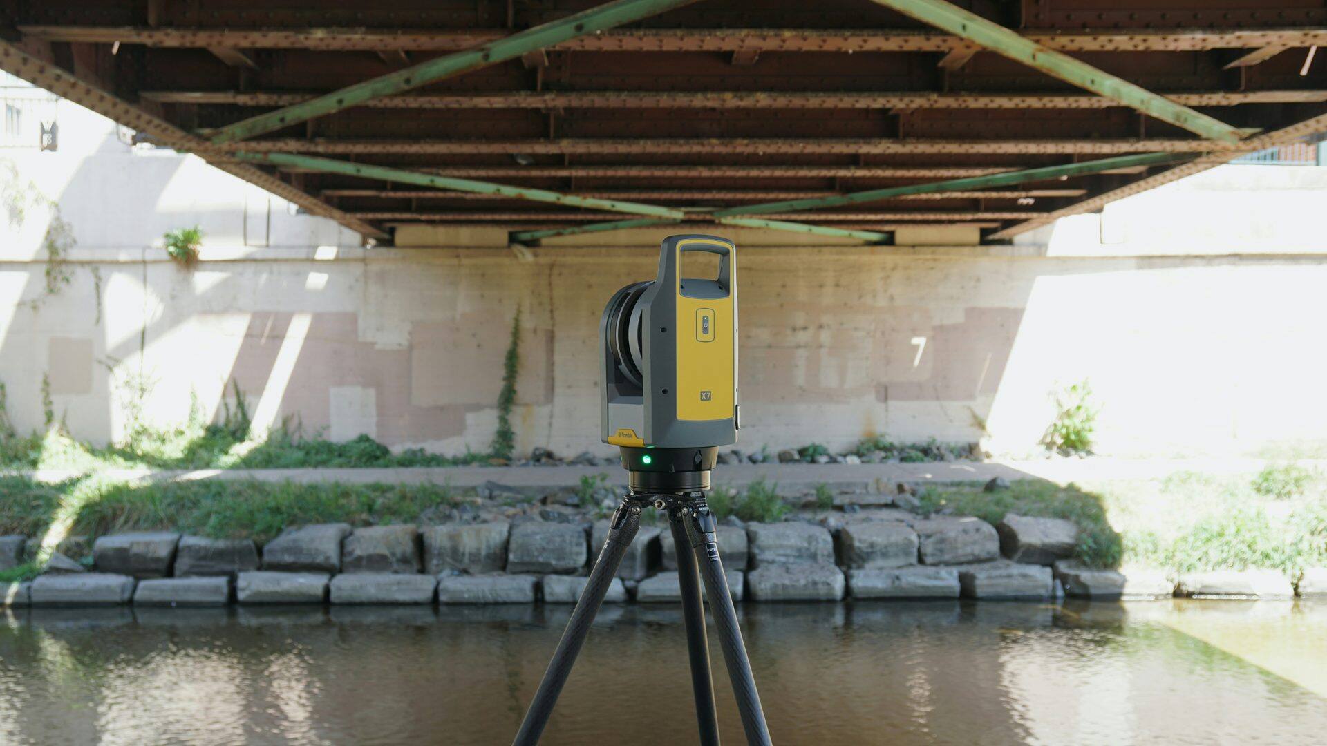
Laser capture of large spaces with Trimble X7. Navigable point clouds for planning, as-built documentation and remote measurements with a range of up to 80 metres.
Trimble X7
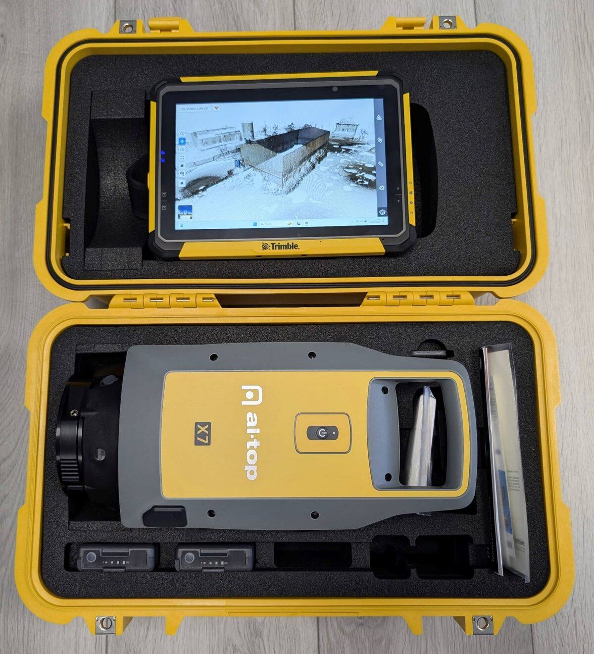
Trimble X7
For large spaces, facilities and complete industrial environments. 360° laser with a range of up to 80 meters.
- Range: up to 80 m
- Field: 360° x 300°
- Accuracy: millimetric
- Ideal for: plants, warehouses, piping
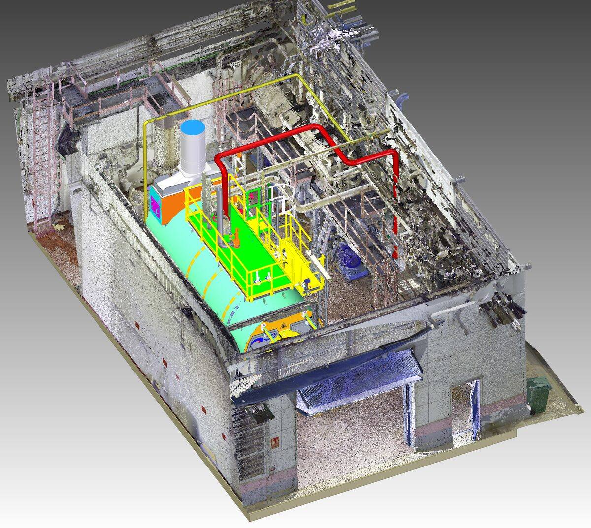
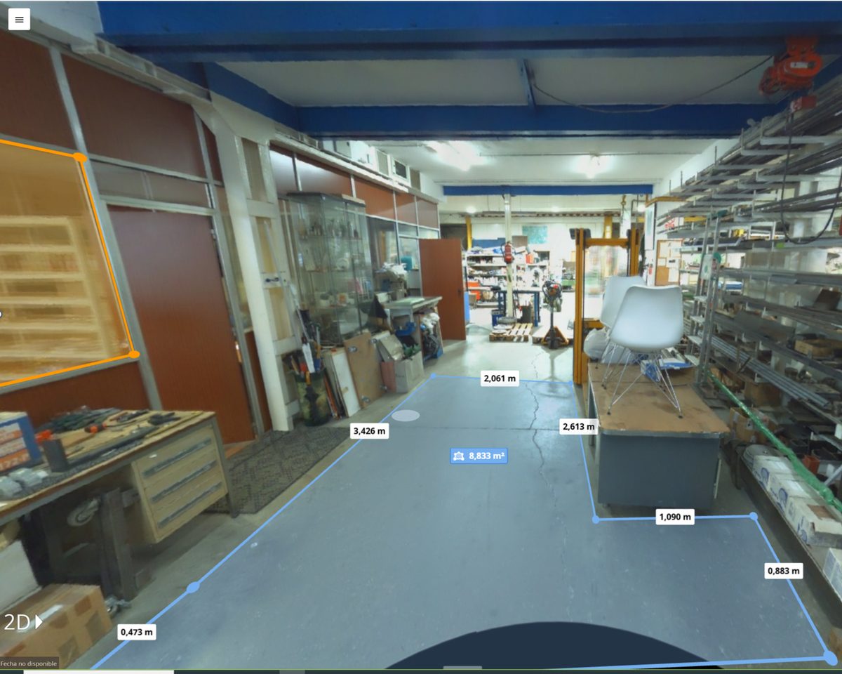
What Is a Point Cloud?
The Trimble X7 emits a laser beam at high speed with a sweep of 360° horizontal and 300° vertical, reaching distances of up to 80 meters. Each laser impact point is recorded in X, Y, Z coordinates, generating a cloud of millions of colored points that faithfully reproduces the geometry of the environment.
The resulting point cloud is a navigable three-dimensional model that allows you to work as if you were physically at the facility: take measurements, generate drawings, plan modifications and much more.

What Can We Do with the Point Cloud?
The Trimble X7 opens a wide range of possibilities for documenting, planning and managing industrial facilities.
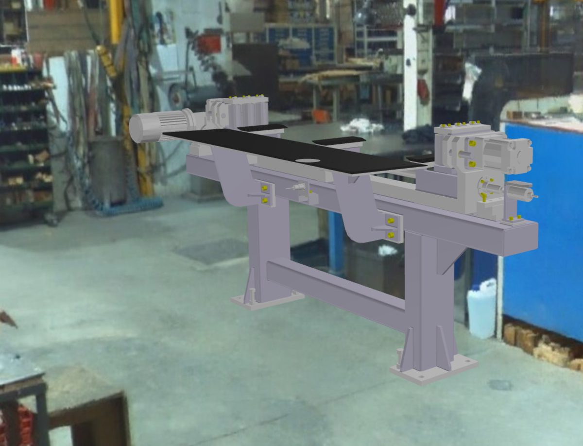
Mixed Reality
Overlay of 3D models on the real point cloud to plan modifications before executing them.
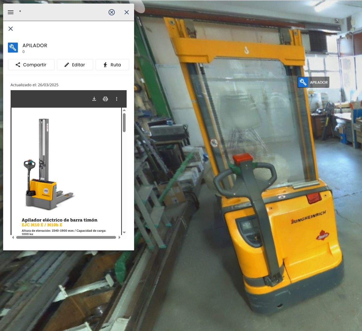
Virtual Tours
Virtual navigation through the facility with equipment labeling for remote inspection.
Model Integration
Design of new machines or equipment directly on the scanned real environment.
Remote Measurements
Precise measurements taken directly from the point cloud, without the need to revisit the facility.
All Applications
Pre-design of facility changes on the point cloud, verifying that everything fits before manufacturing.
Overlay of 3D models on the captured reality for prior visualization and validation.
Generation of floor plan views, elevations and sections for technical documentation.
Precise measurement of distances, angles and volumes directly from the point cloud without traveling to the site.
Cross and longitudinal sections of the point cloud for detailed section drawings.
Share navigable point clouds with clients and teams through web viewers.
Documentation of the actual state of facilities for drawings that reflect the final assembly.
Navigable virtual walkthroughs of the facility with equipment identification and labeling.
Visual verification of equipment and facilities without the need for physical presence on-site.
Periodic tracking of construction or assembly status by comparing point clouds at different dates.
Need to scan parts or components with sub-millimetre accuracy? See 3D Scanning of Parts →
Our Scanning Process
An optimized workflow adapted to large industrial spaces that guarantees complete coverage and professional results.
Analysis
We evaluate the facility, plan the scanner positions and define the capture strategy to cover the entire space.
Capture
We scan with the Trimble X7 from multiple positions, capturing millions of points with complete coverage.
Processing
We align the point clouds from each position, merge and clean the data to generate a navigable 3D model.
Delivery
We deliver the navigable point cloud and the requested deliverables: as-built drawings, layouts, sections, virtual tours or web publishing.
Sectors That Trust Our Scanning
Proven experience in the most demanding industrial sectors in the Basque Country and northern Spain.
Automotive
Scanning of components, tooling and dimensional control of body parts.
Aeronautics
Digitization of aeronautical parts, inspection of critical components and tooling.
Industrial Machinery
Reverse engineering of equipment, facility documentation and component redesign.
Naval
Scanning of hulls, structures and naval components for repair and retrofitting.